Heading

Mapping
in Motion
Our Services
Revolution Geosystems specializes in airborne acquisition, sensor rentals, survey equipment brokering, integrated multi-platform data acquisition, geospatial software, and general aviation MX.
.webp)
Rentals
.avif)
.avif)


Empowering the World's Mapmakers
At Revolution Geosystems, our mission is to support our clients’ objectives by delivering precise, reliable, and comprehensive aerial data acquisition services. We combine advanced technology with proven aviation expertise to provide actionable geospatial intelligence for a rapidly evolving world. With an uncompromising focus on safety, quality, and operational excellence, we enhance our clients’ efficiency and reliability across every mission we undertake.
Meet the Fleet
We are breaking down the barriers to high-quality geospatial data with a fleet and sensor ecosystem built for the future of mapping.

.avif)


.avif)

.webp)
Frequently Asked Questions
What core geospatial services does Revolution Geosystems provide?
Revolution Geosystems (RevGeo) provides an integrated, end-to-end ecosystem for the geomatics industries. Our comprehensive capabilities include airborne data acquisition (aerial photography, photogrammetry, and lidar data acquisition), premium aerial survey sensor rentals, an international marketplace for buying and selling used survey gear, and integrated Phoenix lidar hardware and software. Our dedicated team delivers industry-leading flight operations expertise and remote sensing aircraft, sensors, and software so that our clients can deliver actionable geospatial intelligence to inform critical decisions for our world.
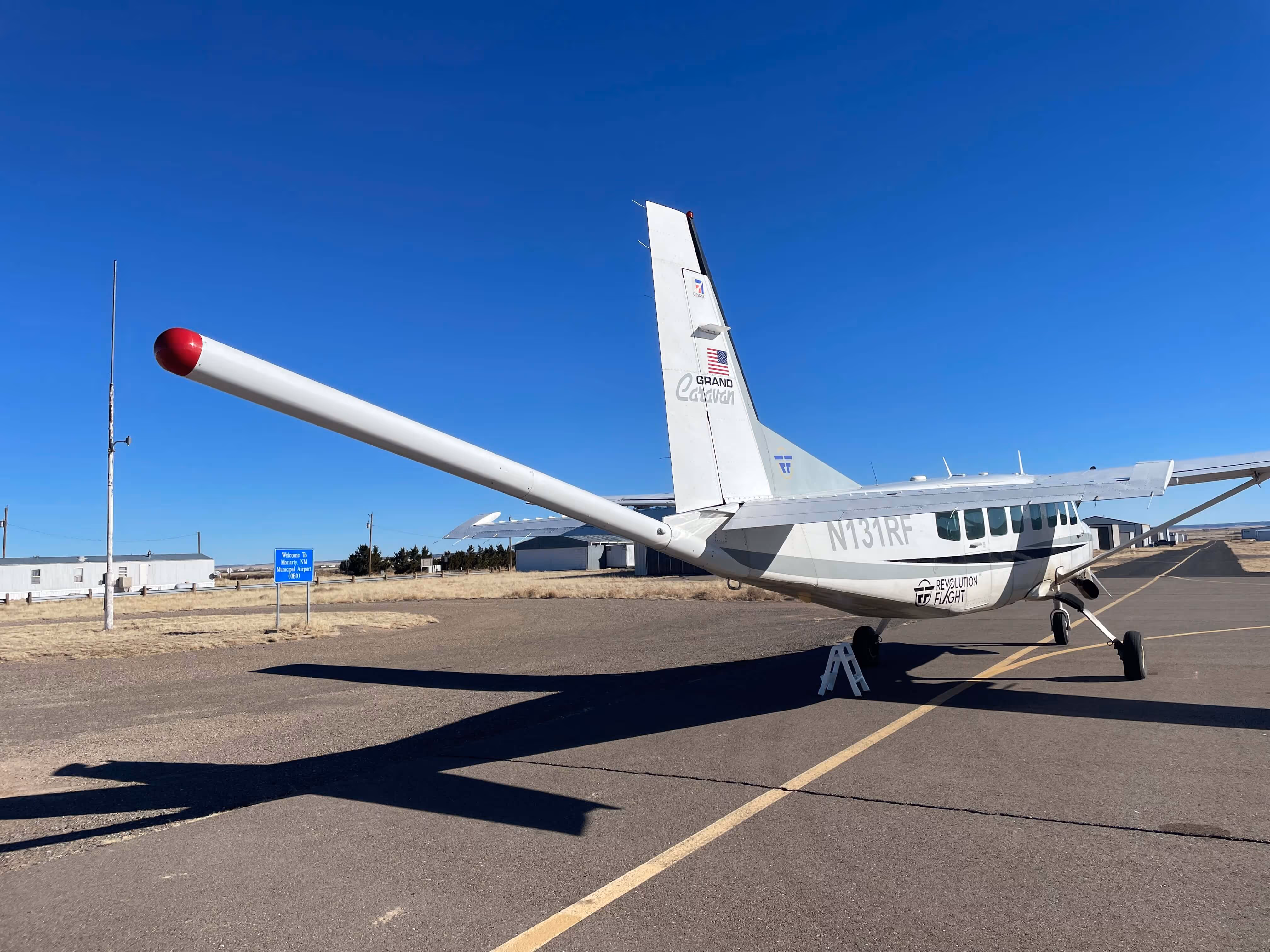
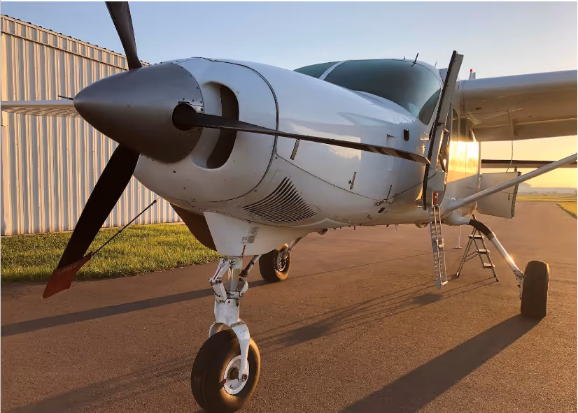
What types of aircraft make up the Revolution Geosystems data acquisition fleet?
Our specialized fleet consists of modern, specialized aircraft tailored to diverse flight profiles and mission requirements. Key airframes include the turbine Cessna Caravan, ideal for heavy payloads, large Areas of Interest (AOIs), and high altitudes. Our high-thrust 950-horsepower Cessna Supervan is optimized for rapid climbs and high-terrain efficiency. Our highly cost-effective piston-engine Cessna 206H serves as a "low and slow" aerial survey workhorse platform for high-density localized collection.
Where are Revolution Geosystems’ primary operational bases and facilities located?
RevGeo supports global remote sensing and aviation operations through four primary strategic locations. Our corporate headquarters, flight operations center, and primary FAA Part 145 repair station are based in Huntsville, Alabama (KHSV). We also operate a dedicated Arctic and sub-Arctic aircraft maintenance and mission facility in Palmer, Alaska (PAQ). Our Phoenix LiDAR Systems business is based in Austin, Texas, and our international operations office in Limerick, Ireland supports our EMEA brokerage clients.
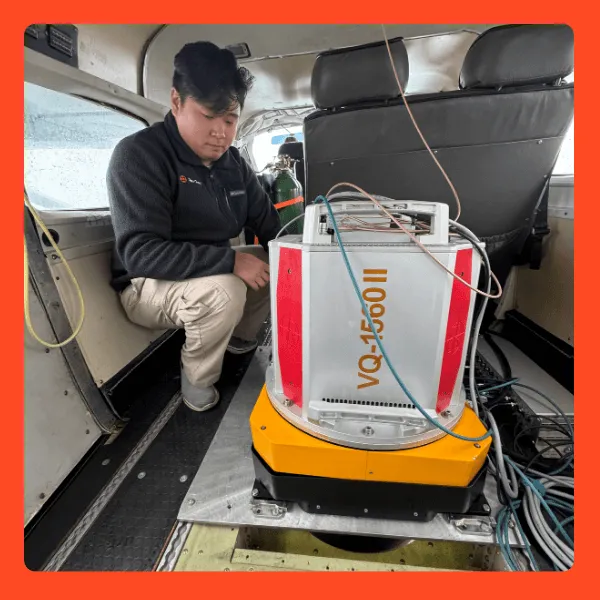
What sensor systems are available for aerial data acquisition?
We maintain a premium fleet of remote sensing equipment available for short- or long-term rental. Our inventory features high-altitude, dual-channel lidar sensors like the RIEGL VQ-1560 II, II-S, and III-S. We also offer the Vexcel Ultracam Eagle Mark III aerial camera sensor and medium-format Phase One aerial cameras. Somag GSM 4000 and 5000 gyro-stabilized mounts can be rented standalone or integrated with a sensor. Additionally, we provide mobile, UAV, and manned-aircraft turnkey systems from Phoenix LiDAR Systems, supported by full software suites for flight planning and post-processing.
How does the acquisition of Phoenix LiDAR Systems enhance Revolution Geosystems' capabilities?
The integration of Phoenix lidar Systems expands RevGeo from an aviation and data-collection provider into a geospatial sensor integrator and software development house. This allows us to supply clients with custom-built, multi-platform lidar payloads that scale seamlessly across unmanned aerial vehicles (UAVs/drones), ground-based mobile mapping systems, and traditional manned aircraft. Clients benefit from a unified pipeline linking sensor engineering, flight operations, and process-ready data.
What capabilities does your FAA Part 145 Certified Repair Station offer?
Operating as General Aviation Maintenance (GAMX) under FAA Repair Station Certificate #6EVR752D in Huntsville, AL, and Palmer, AK, we provide full-service MRO (Maintenance, Repair, and Overhaul) support. We specialize in airframe modifications, quality sheet metal repair, gear overhauls, gear up landing repairs, propeller replacements and overhauls. As an authorized Garmin dealer, we can execute avionics retrofits and upgrades. Our technicians have decades of experience in engine overhaul, repair, and replacement. nd external commercial and fleet operators maintain maximum uptime.
